Environmental Authorisation is required by legislations and the process that needs to be followed is also governed by legislation. The commencement of listed activities (e.g., constructing, mining, storing, extracting, etc.) may not be initiated without being duly authorised by the respective Competent Authority. The most used legislations relate to:
- The National Environmental Management Act, Act 107 of 1998.
- The National Water Act, Act 36 of 1998.
- The National Environmental Management Waste Act, Act 59 of 2008.
- The Mineral and Petroleum Resources Development Act, Act 28 of 2002.
EnviroMatrix offers consultancy services and assessments by:
- Identifying and assessing both negative and positive environmental impacts through desktop reviews, public participation processes, and site investigations.
- Identifying practical and achievable mitigation and management measures as well as developing appropriate management plans.
- Compiling environmental reports in accordance with the relevant environmental legislative requirements.
- Formulating environmental policies, strategies, and guidelines.
- Implementing and monitoring environmental management systems and plans according to the environmental authorisation issued by the relevant Competent Authority.

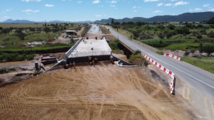
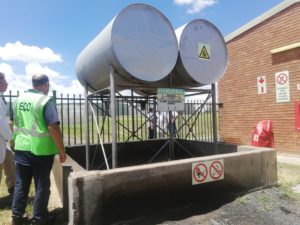
The Environmental Authorisation (EA) issued by the Competent Authority may specify the requirements for frequent audits and construction monitoring to take place in compliance with the conditions set in the EA and the Environmental Management Plan (EMP) compiled. Regulation 19(4) of the National Environmental Management Act, Act 107 of 1998 and Appendix 4 of the Environmental Impact Assessment Regulations (R982 of 04 December 2014, as amended) provides the content requirements for an EMP which is made compulsory in the approval of the project by the Competent Authority.
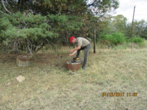
EnviroMatrix GIS offers environmental audits and construction monitoring by using the EMP and EA conditions to:
- Establish, approve, and maintain environmental policy.
- Eliminate or minimise risks to the natural environment and surrounding residents/land users.
- Develop, maintain, and enforce environmental procedures and standards.
- Demonstrate to all stakeholders that policies, procedures, and practices are in conformity with legislative requirements.
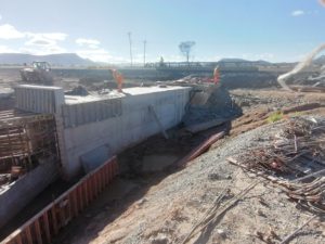
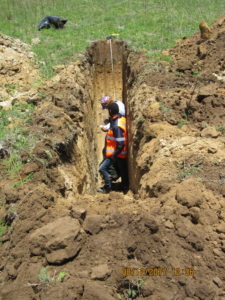
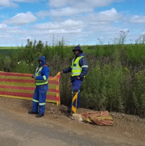
Within the working environment and during the construction period, the Occupational Health and Safety Act, Act 85 of 1993 and associated regulations, needs to be adhered to.
EnviroMatrix GIS offers occupational health and safety assessments and audits which include:
- The establishment, approval, and maintenance of occupational health and safety systems.
- Eliminating or minimising risks to everybody that may be exposed to work-related hazards.
- Developing, maintaining, and enforcing policies.
- Demonstrating to all stakeholders that policies, procedures, and practices are in conformity with the requirements of the regulations.


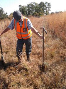
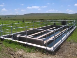
Our clients (e.g., farmers) often require accurate measurements of a specific area (e.g., cultivated fields). These measurements can be used to calculate fertiliser usage and/or material purchases.
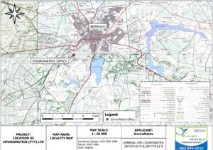
EnviroMatrix offers Geographical Information System (GIS) assessments which include:
- Global Positioning System (GPS) surveying of agricultural fields and pastures.
- Geographical data analyses to produce maps, calculate hectares, and measure boundaries.
- Producing various assessment maps for development areas (e.g., vegetation, geological, and topographical maps).
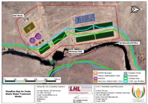

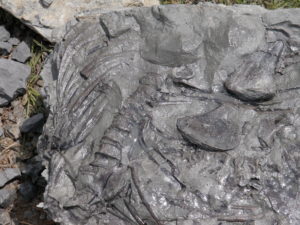
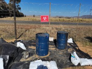
Specialist services are often required as part of Environmental Authorisation Services and associated legislations.
EnviroMatrix assists with specialist services which may include:
- Ecological specialist studies (including terrestrial or aquatic fauna or flora).
- Palaeontological and/or heritage studies.
- Wetland delineations and/or floodline determinations.
- Geohydrological and/or geotechnical assessments.